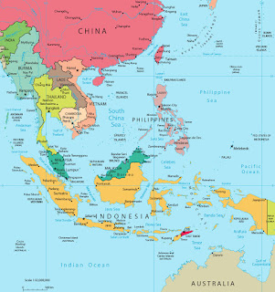
GEOPOLITICS IN SOUTH CHINA SEA
 |
| The map of South East Asia- google image |
 |
| -geopolitic of SEA in 7th century; google image |
The South China Sea is actually a recently given name by a french cartographer. In other words, it was a name given by outsiders during colonial era. The local name is mostly used is Laut Champa or Champa Sea due to the existant of the kingdom of Champa that existed from 192 AD until 1832 before being invaded by Dai Viet in the north. Recently, Republic of Indonesia planned to produced their own chart and replace the name South China Sea into Natuna Sea in other to protect their archipelago from any unnecessary claim.
-DigitalGlobe
 |
| -South China Morning Post |
From the above map, we can see the territorial dispute between the countries compare to the below map where China claim almost the whole South China Sea. They define it by 9 dash lines.
-South China Morning Post


Comments
Post a Comment